
The church's slightly curious name - similar to many other church names in the City - refers to its site. Any church with the word "without" in its name was situated outside the old city walls, in the case of St Giles outside the Cripplegate. Other examples include St Sepulchre without Newgate, St Botolph without Bishopsgate and the long gone St Ewan within Newgate. Although St Giles is a patron saint of beggars and cripples, the origins of the name "Cripplegate" may lie in the Saxon word "crepel", meaning a covered passage. Indeed, old documents sometimes use the spelling "Crepelgate".
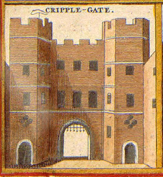 |
| Cripplegate in c.1650. Image sourced from Wikipedia. |
During the Second World War, the Cripplegate area was particularly badly bombed. By 1951 only 48 people were registered as living within the Cripplegate ward, so widespread was the damage.
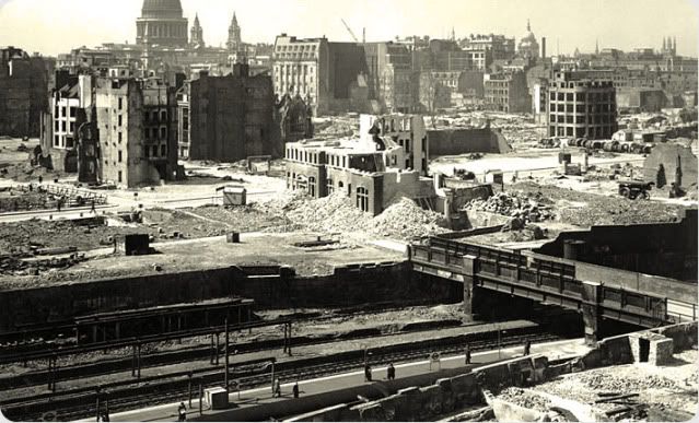 |
| Source |
The above picture looks south over either Moorgate or, more likely, Aldersgate (now renamed Barbican) tube station towards St Paul's, showing the vast extent of devastation in this part of London.
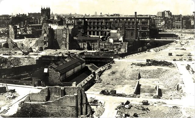 |
| Source |
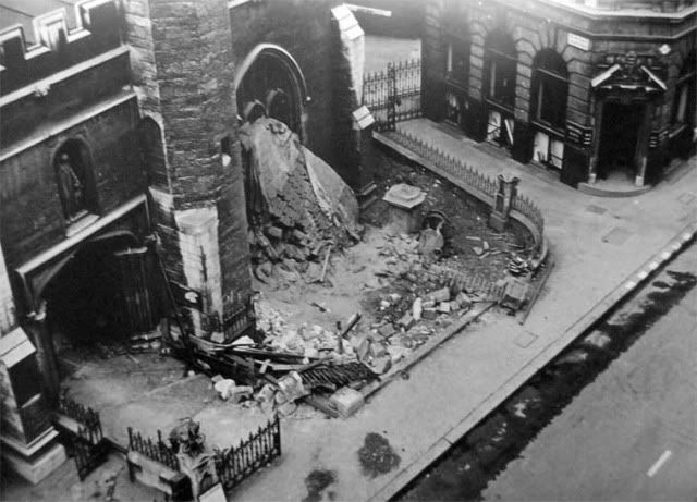 |
| The first wave of bomb damage to St Giles. Source. |
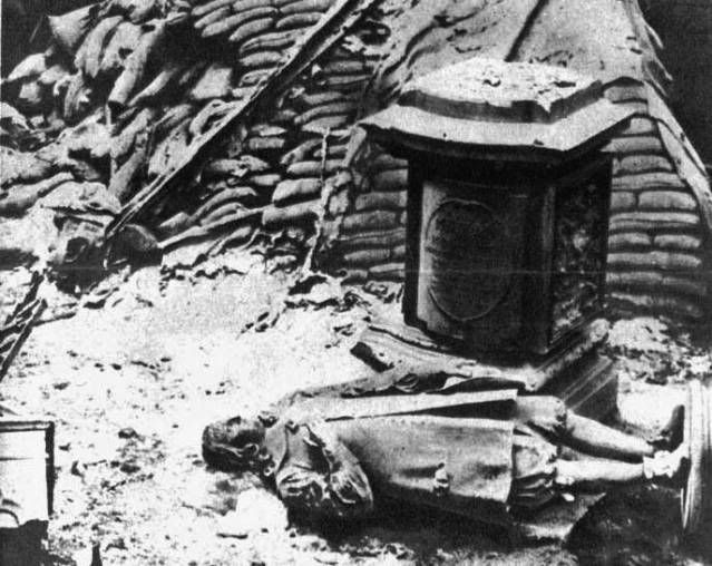 |
| The fallen monument to Milton. Source. |

This picture of St Giles shows how the church has been rebuilt over the years - by the time of its battering in the Blitz it had already undergone significant structural changes and repairs. The roof area, for example, is noticeably modern but is in keeping with the building's Perpendicular Gothic style.
Around St Giles, plans were being drawn up for an enormous new housing estate. A large estate, the Golden Lane Estate, had been built in the area immediately north of Cripplegate in the 1950s and in 1965 work began on the estate now known as the Barbican.

The Barbican Estate is built in the Brutalist architectural style, which was popular in the postwar era and was known for its use of concrete - the term "brutalist" comes from the French béton brut meaning "raw concrete". This use of concrete was the downfall of a number of large housing developments from this period as the concrete used was not of sufficient quality and subsequently, many estates have had to be demolished due to structures becoming unsafe. This was not the case with the Barbican, which utilised a high grade concrete which has not deteriorated over time. The estate was awarded Grade II listed status in 2001 due to its ambitious scale and innovative design - its buildings were connected by highwalks (the "streets in the sky" so often utilised in postwar architecture, with varying success) and the estate also contained many green spaces, including two large lakes. Today the estate remains a popular residential area, with properties changing hands for very high prices.
The Barbican conists of a number of mid-rise blocks and three very tall towers - Shakespeare, Cromwell and Lauderdale - which were, until the Pan Peninsula complex was built at Canary Wharf, the tallest residential buildings in London. The estate is also home to the Barbican Centre, a major arts venue, the Guildhall School of Music and Drama, the City of London School for Girls and the Museum of London.

Despite being almost fifty years old in places, the Barbican still feels like a very futuristic place. Many examples of "streets in the sky" or brutalist housing estates were failures, either down to poor building materials or ill-thought out design that led to the estates becoming hotbeds for crime and neglect. The Barbican is an unusual example of a scheme that can be seen to have been a success - although its success has come at the cost of considerable gentrification, it could be argued.
In amongst all this retro-futuristic concrete, St Giles without Cripplegate remains. Alongside it are some structures even more ancient than the old church - the remains of part of London's Roman Wall and its medieval additions.

The above photograph, looking from Wallside over to the City of London School for Girls, shows the 13th century bastion tower that was added to the fortifications on London's wall.

Several different types of stone and building styles can be seen in the wall, showing how the wall was repaired and strengthened over the years. Several large sections of the old city wall survive in the Cripplegate area - many were exposed by the destruction of the Blitz and today are preserved.
Finally, this blog wouldn't be complete without a gravestone or two - here, some of the old tombstones from St Giles' churchyard have been set into the walls of one of the Barbican's lakes.

Whether or not Brutalist architecture is your cup of tea - it remains one of the most divisive architectural styles of modern times - the Barbican is well worth a visit, even though it is quite easy to get lost on the highwalks. It is easily accessible from the Museum of London, or from the footbridge from the exit of Barbican tube station. Although little remains of the old Cripplegate area, the surviving ancient church and wall fragments give the estate a sense of what was there before the German bombs fell.
Good site!
ReplyDeleteAlthough this is a comment to an old post, the third picture that says "...looks south over either Moorgate or, more likely, Aldersgate (now renamed Barbican) tube station towards St Paul's", it is in fact Moorgate (Google Earth's Historical Imagery helped) and was probably take from about New Union Street. If if works this link (to GE view in Google maps) is taken at a slightly higher elevation (to see St P's) and shows the same configuration of St Pauls Dome to its Western end towers. http://goo.gl/maps/DiVZZ. If it had been taken from Barbican(Aldersgate) tube station the two towers would almost be in line with each other.
Thanks for sharing great content. It is very informative for me. I'm regular reader of your blog keep sharing such a information to us.
ReplyDeleteHouse Extension in Hammersmith